
Fájl:Nottinghamshire UK locator map 2010.svg

Ennek a(z) SVG fájlnak ezen PNG formátumú előnézete: 494 × 600 képpont. További felbontások: 198 × 240 képpont | 395 × 480 képpont | 633 × 768 képpont | 843 × 1 024 képpont | 1 687 × 2 048 képpont | 1 108 × 1 345 képpont.
Eredeti fájl (SVG fájl, névlegesen 1 108 × 1 345 képpont, fájlméret: 302 KB)
|
Ez a fájl a Wikimedia Commonsból származik. Az alább látható leírás az ottani dokumentációjának másolata. A Commons projekt szabad licencű kép- és multimédiatár. Segíts te is az építésében! |
Összefoglaló
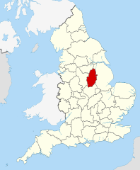
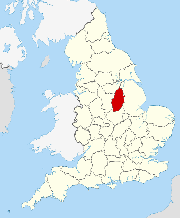
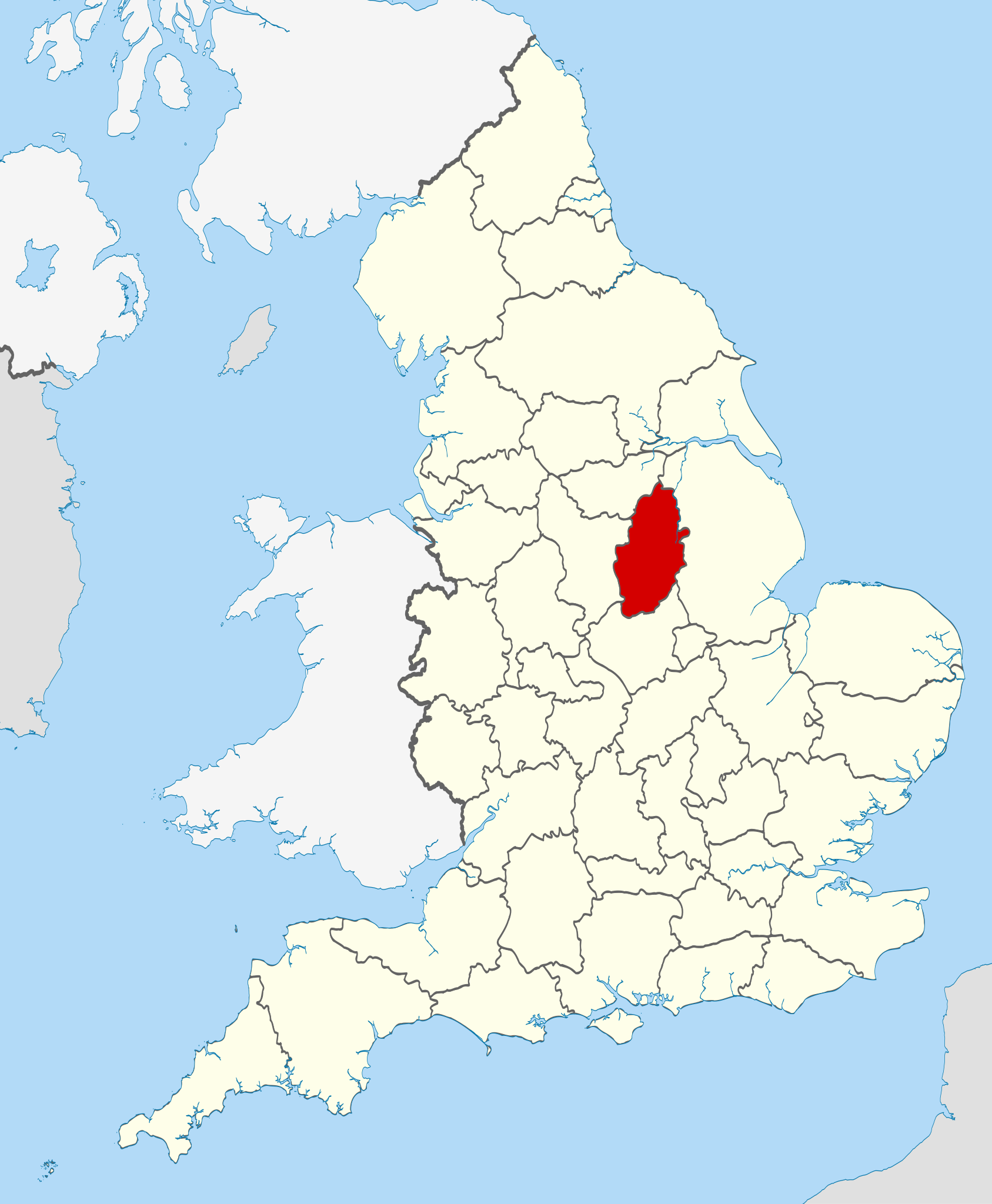
| Leírás | Location of the ceremonial county of Nottinghamshire within England. |
| Dátum | |
| Forrás |
National Geospatial-Intelligence Agency
|
| Szerző | Nilfanion |
Licenc
Én, e mű szerzője a művemet az alábbi licencek alatt teszem közzé:
Ez a fájl a Creative Commons Nevezd meg! – Így add tovább! 3.0 Unported licenc alapján használható fel.
- A következőket teheted a művel:
- megoszthatod – szabadon másolhatod, terjesztheted, bemutathatod és előadhatod a művet
- feldolgozhatod – származékos műveket hozhatsz létre
- Az alábbi feltételekkel:
- Nevezd meg! – A szerzőt megfelelően fel kell tüntetned, hivatkozást kell létrehoznod a licencre és jelezned kell, ha a művön változtatást hajtottál végre. Ezt bármilyen észszerű módon megteheted, kivéve oly módon, ami azt sugallná hogy a jogosult támogat téged vagy a felhasználásod körülményeit.
- Így add tovább! – Ha megváltoztatod, átalakítod, feldolgozod ezt a művet, a közreműködésedet csak az eredetivel megegyező vagy hasonló licenc alatt terjesztheted.

|
Ez a fájl szabadon másolható, terjeszthető és/vagy módosítható a GNU Szabad Dokumentációs Licenc feltételei alapján, az 1.2 vagy későbbi, a Free Software Foundation által publikált Nem Változtatható szakaszok, Címlapszövegek és Hátlapszövegek nélküli változat szerint. E licenc egy példánya a GNU Szabad Dokumentációs Licenc című fejezetben olvasható. |
A mű a fenti licencek bármelyike szerint felhasználható.

|
This is one of the images forming part of the Valued image set: Locator maps of the Ceremonial counties of England on Wikimedia Commons. The image set has been assessed under the valued image set criteria and is considered the most valued set on Commons within the scope:
Locator maps of the Ceremonial counties of England
You can see its nomination at Commons:Valued image candidates/Locator maps of English ceremonial counties. |
Fájltörténet
Kattints egy időpontra, hogy a fájl akkori állapotát láthasd.
| Dátum/idő | Bélyegkép | Felbontás | Feltöltő | Megjegyzés | |
|---|---|---|---|---|---|
| aktuális | 2010. november 24., 00:42 | | 1 108 × 1 345 (302 KB) | Nilfanion | == Summary == {{Information |Description=Location of the ceremonial county of Nottinghamshire within England. |Source=Ordnance Survey [https://www.ordnancesurvey.co.uk/opendatadownload/products.html OpenData]: * |
Fájlhasználat
Az alábbi lap használja ezt a fájlt:
Globális fájlhasználat
A következő wikik használják ezt a fájlt:
- Használata itt: af.wikipedia.org
- Használata itt: ar.wikipedia.org
- Használata itt: arz.wikipedia.org
- Használata itt: ast.wikipedia.org
- Használata itt: be-tarask.wikipedia.org
- Használata itt: be.wikipedia.org
- Használata itt: bg.wikipedia.org
- Használata itt: br.wikipedia.org
- Használata itt: bs.wikipedia.org
- Használata itt: ca.wikipedia.org
- Használata itt: ceb.wikipedia.org
- Használata itt: cs.wikipedia.org
- Használata itt: dag.wikipedia.org
- Használata itt: da.wikipedia.org
- Használata itt: de.wikipedia.org
- Használata itt: en.wikipedia.org
- Nottinghamshire
- University Farm (Nottinghamshire)
- Bircotes
- Manton, Nottinghamshire
- Soar Valley
- Redhill, Nottinghamshire
- Spion Kop, Nottinghamshire
- Ratcliffe-on-Soar
- Bunny, Nottinghamshire
- North Leverton with Habblesthorpe
- Adbolton
- Barton in Fabis
- Trent Lock
- Template:Nottinghamshire-geo-stub
- Wilford Hill
- Rhodesia, Nottinghamshire
- Meering
- Annesley
- Askham, Nottinghamshire
- Awsworth
- Barnby in the Willows
- Bathley
- Beckingham, Nottinghamshire
- Bestwood St. Albans
- Bevercotes
- Kneeton
- Beeston and Stapleford Urban District
- Bothamsall
- Bulcote
- Worksop Rural District
- Butler's Hill
- Westville, Nottinghamshire
A fájl globális használatának megtekintése